Shanghai does not have one riverfront experience. The classic Bund is a protected historic district facing Lujiazui. North Bund looks toward the same skyline from farther north and carries its own passenger-port history. Pudong's east bank places visitors beneath the towers they viewed from Puxi. West Bund in Xuhui is a longer cultural and industrial waterfront where museums and reused infrastructure matter as much as the postcard skyline.
Choose one bank for its purpose, then decide whether crossing the Huangpu River improves the route. A public ferry is transport with a view; a sightseeing cruise is a separate excursion. Ferry lines, piers, fares and operating hours can change, and waterfront events can affect movement. Use the municipal transport page and the relevant district or venue pages shortly before visiting. The combinations below are editorial suggestions, not live service promises.
At a glance
Start here
- Choose the Bund for historic facades facing the modern skyline.
- Choose North Bund for a wider skyline angle and passenger-port context.
- Choose West Bund for public space, industrial traces and art institutions.
- Use a ferry only after confirming the current line and both piers.
01
Choose the riverfront by purpose
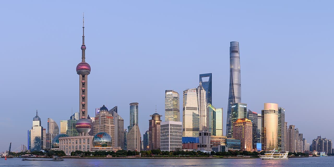
The Bund works when the central question is how Shanghai's historic commercial facades confront the modern towers across the Huangpu. The municipal profile describes a 1.5-kilometre protected waterfront with a group of former financial and trading buildings. It is a linear architecture view, not simply a single photo point.
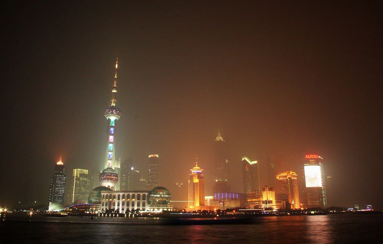
North Bund is useful for a broader Lujiazui panorama and port history. West Bund is useful for a longer walk through a transformed industrial landscape and a cultural cluster. Pudong's central riverfront reverses the perspective: the towers stand nearby while the Bund becomes the view across the water. Selecting the purpose first prevents a repetitive day of seeing the same skyline from several banks without understanding why each bank differs.
- Historic commercial architecture: the Bund.
- Passenger-port context and wide skyline: North Bund.
- Industrial reuse and art: West Bund.
02
Read the Bund in two directions
On the Bund, look west toward the protected facade line as deliberately as you look east toward Lujiazui. The official page identifies former financial and trading uses among the buildings and describes the waterfront as an outdoor museum of international architecture. That history gives the promenade its tension: one bank frames an earlier commercial city while the other displays a later vertical centre.
Walk one coherent section rather than repeatedly stopping in the busiest central space. If photography is the priority, take the image and move clear of the main pedestrian flow before reviewing it. The official source describes patterns across morning, day and evening, but this guide does not promise a quiet period or a lighting schedule. Current crowd management and illumination arrangements should be checked through municipal notices when relevant.
- Alternate attention between facades and opposite-bank skyline.
- Keep moving after a photograph.
- Check current public-space notices for special dates.
03
Use North Bund for port context
The North Bund International Passenger Center occupies a Huangpu shoreline facing Lujiazui and adjoining the historic Bund cluster. Its municipal profile emphasises the passenger terminal's long port role as well as the open waterfront view. This makes it more than an alternative camera angle: the relationship between river transport, arrival and modern skyline is the subject.
Plan North Bund as its own short waterfront block or connect it to the Suzhou Creek mouth and Waibaidu Bridge area. Do not describe a continuous waterside path between every named point without checking current access and construction. A mapped street connection may be required. If the classic Bund already fills the day, North Bund is better saved for a later architecture or port-focused visit rather than added as another compulsory viewpoint.
- Go for the port-and-skyline relationship.
- Map the connection to Suzhou Creek separately.
- Check current waterfront access before assuming continuity.
04
Give West Bund enough time
West Bund's official open-space page describes a Xuhui riverfront built around broad public walking space and retained industrial elements, including railway and wharf traces and a former conveyor structure. Its scale and cultural institutions make it unsuitable as a ten-minute substitute for the central Bund. The pleasure comes from moving between landscape, infrastructure and art rather than reproducing the same famous skyline frame.
Choose one museum or cultural institution as the fixed point, then walk only the section that supports it. West Bund Museum, for example, has entrances on the river and Longteng Avenue, but its exhibitions and admission are separate from the open space. Check the weather, museum visit page and transport before setting out. A one-way walk ending near the selected venue is often clearer than trying to cover the full waterfront and return.
- Anchor the outing with one cultural venue.
- Select a defined waterfront section.
- Map a different exit point if walking one way.
05
Use a public ferry as a real crossing
Shanghai's municipal transport portal describes ferries as working links between Puxi and Pudong, not only sightseeing products. Its current boat guide lists multiple regular lines and directs travellers to the Shanghai Ferry official account for updated hours. That last step matters: line names, service windows and pier availability are operational details, not permanent facts.
Choose a ferry when both piers improve the itinerary. Identify the departure pier, arrival pier and onward route before boarding. A scenic crossing that leaves you far from the next destination can create more travel than it saves. Keep metro as the documented alternative if weather or service changes affect the chosen line. A ferry offers an open river perspective, but it should still solve a transport problem.
- Verify both pier names in the current official listing.
- Map the onward journey from the arrival bank.
- Keep a metro alternative.
06
Distinguish a ferry from a sightseeing cruise
A regular ferry crosses the river as part of the transport network. A Huangpu sightseeing cruise sells a longer view from the water and normally returns according to its own route. The municipal boat guide treats them as separate products and publishes different piers and ticket information. Decide whether the aim is to change banks or spend a dedicated block on the river.
For a cruise, confirm the current operator, departure pier, route, duration, ticket conditions and return point directly. Do not build an evening around an old price or departure table. For a ferry, the same-day operational check is more important than advance purchase. Choosing one prevents duplication: a traveller already satisfied with a public crossing and two riverfront walks may not need a cruise as well.
- Ferry: transport between two useful banks.
- Cruise: a dedicated sightseeing activity.
- Check the exact pier and return arrangement.
07
Assemble one coherent river day
A compact classic route starts with the Bund's facades, crosses by a currently operating ferry, and ends with the opposite-bank view in central Pudong. A port-history route links North Bund with the Suzhou Creek mouth area. An art route gives West Bund a museum and a defined one-way promenade. These are three different days; combining all of them weakens their distinctions.
Before departure, check the chosen public-space and transport pages, save both banks' place names, and remove any connection that depends on an unverified service. If river conditions, an event or construction changes the plan, preserve the theme by staying on one bank. The purpose is not maximum shoreline distance. It is to leave with a clear account of how commerce, transport, industry and cultural reuse shaped different edges of the Huangpu.
- Classic route: Bund, verified crossing, central Pudong.
- Port route: North Bund and Suzhou Creek mouth.
- Art route: West Bund venue and promenade.
Useful answers
Reader questions
Which Shanghai riverfront should a first-time visitor choose?
The Bund is the clearest first choice when the goal is the historic facade line facing Lujiazui. Choose West Bund instead for art and industrial reuse, or North Bund for passenger-port context and a wider skyline view.
Sources: Shanghai Municipal People's Government; Shanghai Municipal People's Government; Shanghai West Bund Development (Group) Co LtdIs a Shanghai ferry the same as a Huangpu River cruise?
No. Regular ferries are public transport crossings between Puxi and Pudong. Sightseeing cruises are separate ticketed excursions with their own routes and departure piers.
Sources: Shanghai Municipal People's Government; Shanghai Municipal Commission of TransportCan I rely on a published ferry timetable months in advance?
No. The municipal guide directs passengers to the Shanghai Ferry official account for updated line hours. Verify the chosen line and both piers on the travel day.
Sources: Shanghai Municipal Commission of TransportCan the Bund and West Bund be treated as one continuous walk?
They are distinct waterfront districts with substantial distance between them. Plan the central Bund and Xuhui's West Bund as separate blocks connected by current public transport.
Sources: Shanghai Municipal People's Government; Shanghai West Bund Development (Group) Co LtdRead the evidence
Sources and further reading
These sources support the relevant sections above. Plans and comparisons are editorial suggestions. Check operators for current arrangements.
- The Bund ↗Shanghai Municipal People's Government · Accessed 14 September 2026
The Bund's protected waterfront status, length, former financial and trading buildings and orientation across the Huangpu River.
- The North Bund International Passenger Center ↗Shanghai Municipal People's Government · Accessed 14 September 2026
North Bund riverfront location, view toward Lujiazui and long passenger-port role.
- Public Open Space of Riverside ↗Shanghai West Bund Development (Group) Co Ltd · Accessed 14 September 2026
West Bund public walking space, river setting and retained railway, wharf and industrial-infrastructure elements.
- District Overview ↗Shanghai West Bund Development (Group) Co Ltd · Accessed 14 September 2026
West Bund's Xuhui waterfront extent, industrial transformation and cultural-institution cluster.
- Ferry ↗Shanghai Municipal People's Government · Accessed 14 September 2026
Ferries as public transport connections between Puxi and Pudong and navigation to current ferry guidance.
- Exploring Shanghai by boat ↗Shanghai Municipal Commission of Transport · Accessed 14 September 2026
Current distinction between regular ferries and sightseeing cruises, named ferry lines and instruction to verify live hours through Shanghai Ferry.